Utilities

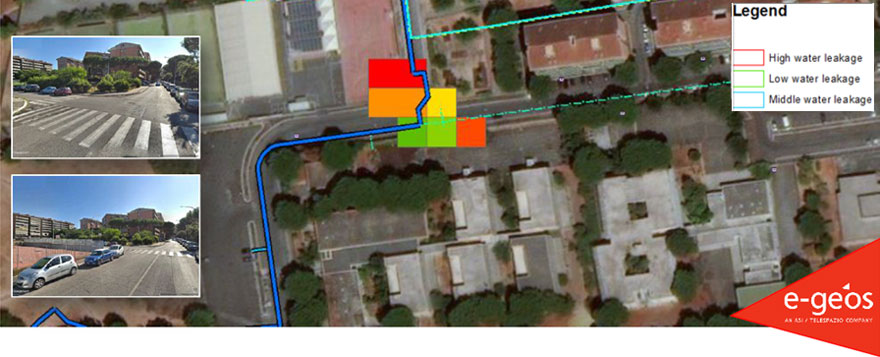
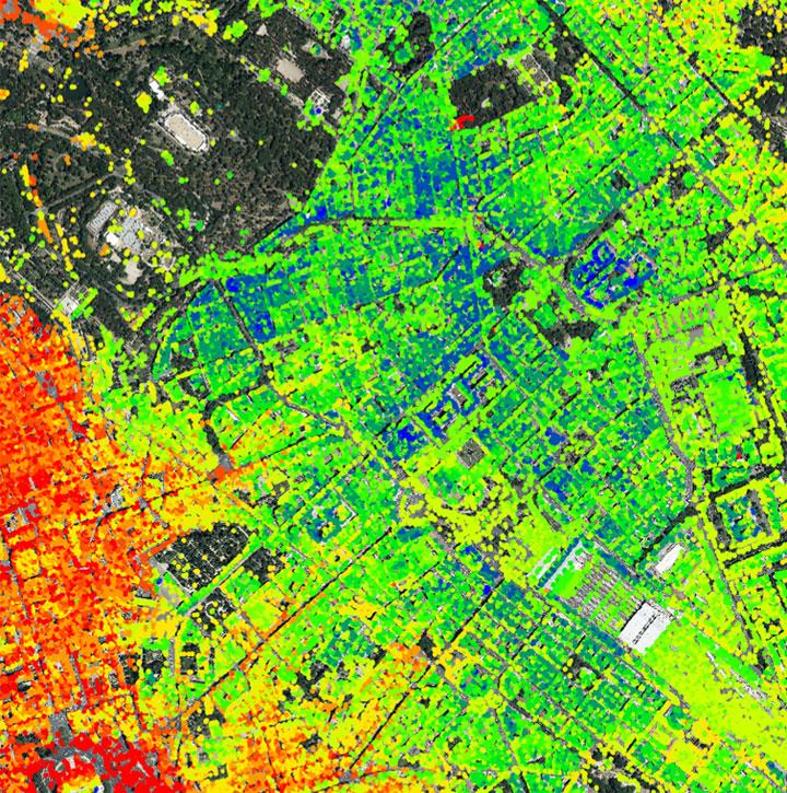
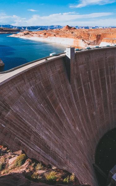
Those operating in the utility sector are responsible for managing the infrastructure that supports basic amenities, such as water, sewage services, electricity, dams and natural gas. Over time, this infrastructure wears down and without appropriate management, results in significant cost implications (e.g., water leaks amount to over 45 billion litres of drinking water loss every day globally). In the case of water and many other utilities, monitoring becomes difficult with traditional techniques over wide and challenging networks.  Satellite technologies provide an indispensable tool for this type of monitoring and offer crucial support for mitigating damage to utility infrastructure. 

Telespazio utility products and services are available through the AWARE platform. They provide the utility sector with the following benefits:

  • Quick response to events that could result in damage to utilities
  • Reducing risk of structural damage and collapse through alert notifications
  • Improved maintenance processes and effective decision making
  • Remote assessments improve safety 
  • Improved efficiency through reduced staff field visits and remote monitoring
  • Improvement in the quality of monitoring data

Services and Products

  • Road network monitoring
  • Dam structural monitoring
  • Powerline monitoring
  • Pipeline monitoring
  • Water leak detection
  • GIS platform development (mobile, web and desktop)
  • Encroachment assessment – vegetation growth and construction site expansion
  • Infrastructure damage assessments
  • SUMMIT-SHM™ – a cutting-edge motion monitoring system based on GNSS technology designed to deliver high accuracy 3D motion monitoring in real time


Contact us to find out more or request a quote

Case Study

e-GEOS, in collaboration with Acea (experts in the management and development of network and services in the water, energy and environmental sectors), has developed a Water Lead Detection prototype that can be immediately ingested in the operational workflow of the infrastructure manager of water assets. The technique uses L-band SAR data acquired by satellite to penetrate the ground. The model takes account of the capillarity of water and the contrast between the dielectric properties of liquid water and dry soil. Optical very high-resolution data is used for quality control.

The Water Leaks Detection product offers a cost-effective way to undertake monthly inspections, as opposed to the traditional 1-5 year in-situ inspections that currently take place. Water level visualisation (illustrated below) is generated by associating areas with higher moisture level to the aqueduct network. Output includes both a qualitative value (high/medium/low) and quantitative value (l/sec) assessment of the water leaks.

Contact us to find out more or request a quote

AWARE

An e-GEOS powered platform for the provision of products, services and advanced analytics tools for the monitoring and management of Critical Assets and Infrastructure.

AWARE