Environment

Landscape Change


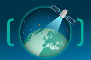
We live in a constantly changing world with natural phenomena and manmade environmental change as widespread as they are commonplace. The Telespazio UK solution to the challenge of how to obtain synoptic and current information is through cost effective environmental mapping and monitoring from Earth Observation satellite imaging. Telespazio UK has developed flowlines using a combination of wide area Sentinel-1 imagery and hot spotting of high resolution SAR for operational and regular national scale change detection services. Automated SAR algorithms detect changes which are analysed by our Earth Observation specialists using open source and commercial optical data to validate and determine cause for:

  • Coastal Erosion and Degradation
  • Agricultural Cropping and Land Capital monitoring
  • Urban and Infrastructure Development
  • Landslides and River Erosion


Contact us for further information

Illegal Logging


Illegal logging threatens some of the world’s most valuable forests – from the Amazon to the Far East. And yet, for many of the people that live in these forests, illegal logging is a vital source of income – sometimes it is the only way to survive. Developing a solution that separates large scale illegal operations from licenced and permitted removal is at the heart of Telespazio’s forestry service.

Developed using a SAR and optical satellite data processing chain, this service provides custom deforestation alerts to assist Forest Law Enforcement, Governance and Trade (FLEGT) organisations.

Contact us for further information

Flood Mapping


Around 5.2m (one-sixth) of properties in England are at risk of flooding. More than 2.4m properties are at risk of flooding from rivers or the sea, of which nearly 0.5m are at significant risk, and 1m of these are also vulnerable to surface-water flooding. A further 2.8m properties are susceptible to surface water...a situation mirrored in many other flood prone regions of the world.

Telespazio UK has pioneered an innovative SmartTasking™ tool that can acquire SAR imagery before or near peak flow allowing our analysts to create flood extent mapping that is right on cue. Taking advantage of a satellite ground station in the UK, flood hazard maps can be produced within 60 minutes of the data being acquired in space.

Working with flood modelling professionals, products include hydrologically interpolated flood hazard maps based on observable SAR updated every 12 hours and available via WMS (or ReslienceDirect for the UK Resilience Community).

Contact us for further information