


Much more than a data request
- Smart access to information
- Global and 24/7 near real-time monitoring
- Automatic early warning
- Use of multiple sensors
- Integration with maritime traffic data
- Interactive dashboard and analytic
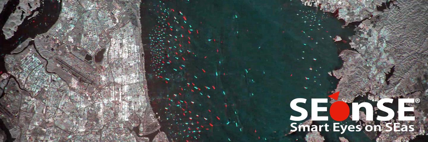
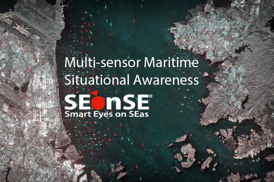
Ship Detection and Tracking
Vessel ID is obtained through the automatic correlation of Earth Observation (EO) data with data from the cooperative systems, such as Automatic Identification Systems (AIS), Long-range Identification and Tracking of Ships (LRIT) and Vessel Monitoring Systems (VMS).
For each ship, the system provides:
- Geo-location including the date and time of detection
- Estimated size, speed and direction
Strategic Surveillance for Intelligence and Security
Extraction of maritime Patterns of Life (PoL) from multi-temporal and multi-sensor observations for conducting risk assessments and identifying threats at sea.
Oil Spill Dispersion Forecasting
- Routine and on-demand sea monitoring services
- Statistical analysis
- Support to emergency management and recovery activities
- Drifting simulation
- Impact assessment on protected areas
Ice Monitoring
Satellite EO and in particular Synthetic Aperture Radar (SAR) instruments represent a reliable tool for ice monitoring, providing a synoptic view complementing the accurate but low coverage reports from ships and airborne sources, for navigation (rivers, lakes and sea) and offshore operations.
Access to geospatial big data analytics and reports
Geospatial Big Data Analytics on long time series of satellite acquisitions fused with other data, such as Automatic Identification Systems (AIS), Long-range Identification and Tracking of Ships (LRIT), Vessel Monitoring Systems (VMS) and Vessel Databases.
- Complete characterisation of vessel behaviour
- Extraction of maritime Patterns of Life (PoL)
- Highlights popular maritime routes, volumes per ship type and activities (e.g. fishing)
Interactive and customisable dashboard for real-time data analysis, supporting the extraction of feature relations over time.
- Real-time interactive dashboard
- Historical data aggregation and correlation
- Heterogeneous data-fusion and presentation
- Ministries of environment
- Oil and gas companies
- Utilities and transportation
- Marine resource management
- Maritime safety coast guards
- Maritime security and intelligence, national navies