


An e-GEOS-powered platform designed to provide fast geo information contents supporting the management of emergency events and business intelligence.
Telespazio UK, together with e-GEOS, provide mapping on-demand services for emergency and disaster management, satisfying near real-time customers’ requests for geo-information data at any time and place in the world.
Much more than a data request
- Smart access to information
- Global and 24/7 near real-time monitoring
- Automatic early warning systems
- Use of multiple sensors
- Interactive dashboard
Social media and news improve emergency products
Social media markers (e.g. Twitter, YouTube) are a rather recent source of information that can be very useful for disaster management activities. In fact, citizens can be considered as sensors providing timely, updated in-situ data for damage assessment. Social media can provide timely and reliable information on the extent of damages during and immediately after natural disasters.
Artificial Intelligence models and crowd-sourcing tasks filter out irrelevant content to enhance the quality of the collected information Natural Language Processing algorithms automatically extract geolocation by analysing the social media text.
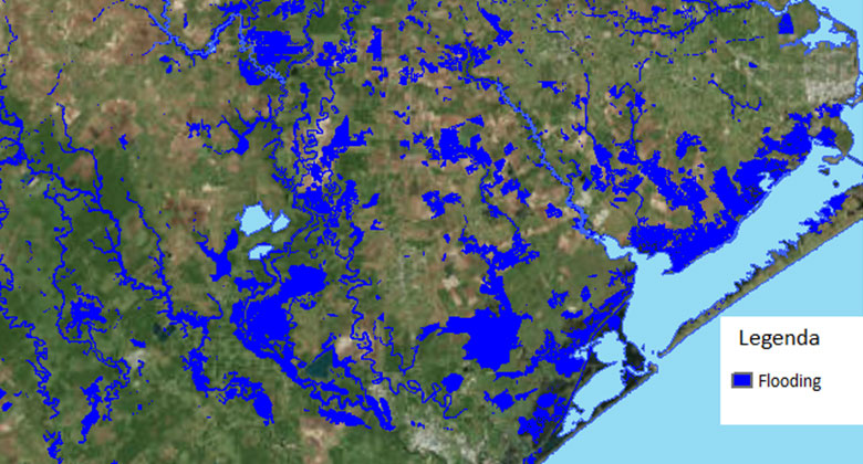
Enhanced Flood Footprint based on integration of hydraulic modelling
Flooding hazard maps are currently generated using appropriate algorithms that allow the detection of floods from SAR and/or optical satellite images or using simulations by hydraulic models.
These approaches are affected by several sources of uncertainties, which have significant consequences on the flooding maps accuracy, especially in urban areas.
The figure below illustrates the Enhanced Flood Footprint, obtained integrating approaches based on a combination of precipitation or streamflow measurements, satellite imagines of flooded areas, hydrological models, markers from social media. It is possible to reduce the uncertainties that affect these technologies by integrating all of these techniques, allowing a more accurate reconstruction of flooded areas.
Copernicus Emergency Management Service (Copernicus EMS) provides all actors involved in the management of natural disasters, man-made emergencies and humanitarian crises with timely and accurate geospatial information derived from satellite remote sensing and available in-situ or open data sources.
The Copernicus EMS consists of two components: Mapping and Early Warning.
The mapping component of the service (Copernicus EMS - Mapping) has a worldwide coverage and provides actors (mainly Civil Protection Authorities and Humanitarian Aid Agencies) with maps based on satellite imagery. The service started operations on 1 April 2012 and it is implemented by the European Commission DG Joint Research Centre (JRC).
The products generated by the service can be used as supplied (e.g. as digital or printed map outputs). They may also be combined with other data sources (e.g. as digital feature sets in a GIS) to support geospatial analysis and decision making processes of emergency managers.
Copernicus EMS - Mapping can support all phases of the emergency management cycle: preparedness, prevention, disaster risk reduction, emergency response and recovery. The early warning component of the Copernicus EMS consists of three different systems:
- The European Flood Awareness System (EFAS), which provides overviews on ongoing and forecasted floods in Europe up to 10 days in advance
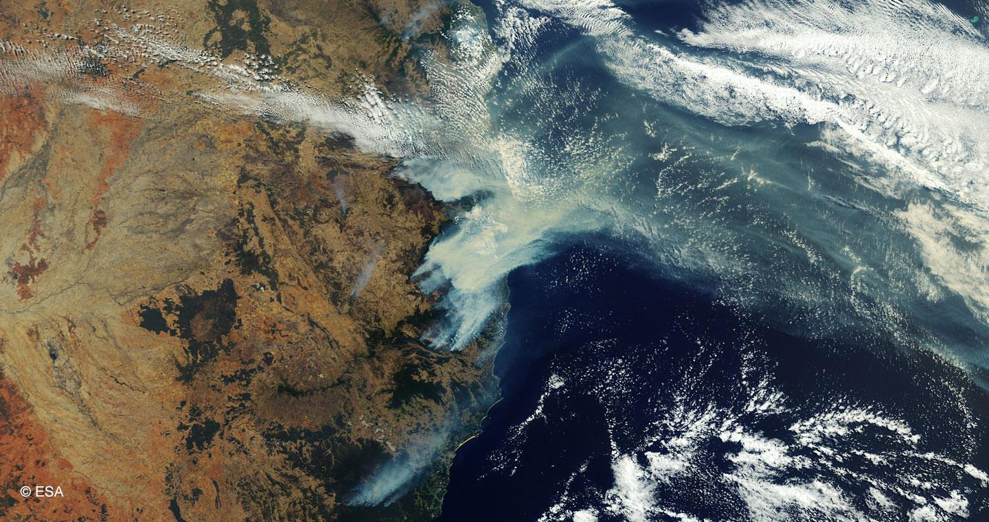
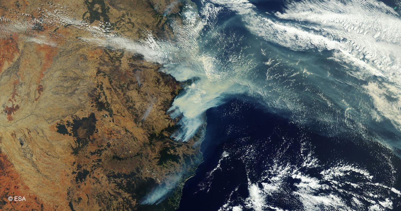
- The European Forest Fire Information System (EFFIS), which provides near real-time and historical information on forest fires and forest fire regimes in the European, Middle Eastern and North African regions
- The European Drought Observatory (EDO), which provides drought-relevant information and early-warnings for Europe.
Global Flood Awareness System (GloFAS), Global Wildfire Information System (GWIS) and Global Drought Observatory (GDO) complete the previous systems at global level.
The service is provided free of charge in rush mode, for emergency management activities which require immediate response and non-rush mode, to support emergency management activities not related to immediate response (read more). It can only be activated by authorised users.
More information on the service is available on the Copernicus EMS – Mapping Portal. The public portal of the Copernicus Emergency Management Service allows users to download the maps and products delivered by this service.
A User Guide for the EMS Service has been produced.
For a more detailed presentation, please refer to the factsheet.