Climate Services

Climate change is the greatest environmental issue of our time. Tackling the problem requires individuals, businesses, communities and countries to recognise and understand physical climate hazards, inherent climate risks and associated impacts and take deliberate steps to mitigate and work alongside such risks.

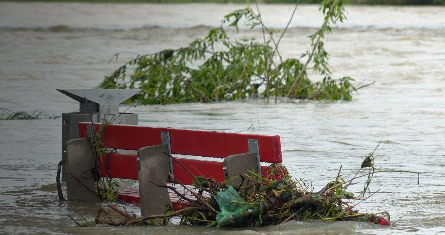
Climate Adaptation shall be central to new mitigation and resilience strategies against frequent and intense hazards, including heat waves, drought, storms, flooding, water scarcity, wildfires and their cumulative effects. Whilst climate adaptation is urgent, efforts must also focus on achieving UK NetZero greenhouse-gas emissions by 2050 to prevent further increases in warming and hazards risk. 

Effectively responding to the socioeconomic impacts of physical climate risks shall see the integration of climate risk into all aspects of governmental and commercial decision-making.

“If you can’t measure it, you can’t manage it”

María Fernanda Espinosa Garcés, President of the United Nations General Assembly, at the COP 24 in Katowice Poland

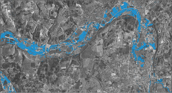
Effectively responding to climate change, observations, measurement and predictions of climate change and associated proxies is critical. Satellites and earth-observation, data analytics offer essential services in this domain by providing routine, systematic, high-quality quantitative data for the world. Without inputs provided by satellites, environmentalists and scientists cannot understand, analyse and predict the impact of climate change, and decision-makers and policymakers will not be able to formulate effective commercial and societal strategies around adaptation and resilience.

Telespazio UK supports stakeholders to better understand physical climate risks, strengthen efforts to move towards NetZero, and adapt to mitigate against natural disasters.

Business Impact


Decision-makers are strongly influenced by historical thresholds for resilience that are based on relative climate stability, but are likely to be breached under our changing climate. Unusual events are becoming more common, which is dramatically increasing risk.

Hazards brought by climate change can undermine workability, food systems, critical assets, infrastructure services and natural capital. Storm events and floods can destroy infrastructure, damage global supply chains, endanger coastal and river communities and result in biome shifts which affect ecosystem services. Even though many coastal cities have already confronted flood risk, the potential direct and in-direct effects of flooding are likely to surge drastically.

Despite hazards often occurring quickly, society’s vulnerabilities to natural disasters lay in its behaviours that in many cases seek to separate the natural world from the human world as a principal risk mitigation strategy. Increasingly, new approaches to climate adaptation seek natural and engineering solutions that allow climate change and its associated phenomena to occur in novel ways that anticipate some level of acceptable impact.

Contact us to find out more or request a quote

Services and Products


Telespazio UK offers support for emergency managers throughout the four phases of disaster management: Mitigation, Preparedness, Response, and Recovery. This includes:

  • Rapid Mapping for Natural Disasters
  • Historical Analysis and Crop Zoning
  • Agricultural Drought Monitoring for Risk Management
  • Risk Evaluation and Damage / Claims Assessments for Critical Infrastructures and Properties

Telespazio UK can support with improving understanding of the underlying causes of climate change, as well as non-disaster related effects. Telespazio’s Forest Watch product supports efforts in Reducing Emissions from Deforestation and Degradation (REDD).

Telespazio UK has experience in developing infrastructure to support climate initiatives, such as online portal to serve ESA’s Climate Change Initiative (CCI) products, and the development of a consolidated view and point of access for all Copernicus Climate Change Service (C3S) datasets within the Climate Data Store (CDS). 


Contact us to find out more or request a quote

Case Study


Telespazio UK Rapid Flood Mapping Service (RFMS) is designed to provide a quick response solution over flooded areas in the immediate lead up to and during a severe weather storm event.

Facilitated by the output of the SmartTasking product, the RFMS utilises the COSMO-SkyMed Synthetic Aperture Radar (SAR) satellite constellation for the provision of near real-time flood mapping during wide spread inundation. Specifically, the delivery of timely flood extent data every 12 hours allows first responder communities and government agencies to act and make decisions for the efficient distribution of limited resources. The product from the RFMS is a satellite-derived spatial dataset that highlights the distribution of visible floodwater.

Main characteristics

  • Utilises Telespazio UK’s SmartTasking product to capture flood extents pre, during and post flood event
  • Products are extracted from both rural and urban land cover types, with greater focus on extracting the extent of flooding within urban environment
  • High accuracy is achieved using additional input layers such as high-resolution DEMs and river flood risk layers
  • Designed to work over the UK but is adaptable for use in other countries

Telespazio UK's in partnership with Ambiental, developed a fully scalable, satellite imagery-based flood management and mitigation service. The project combines satellite SAR observed flood extents with sophisticated hydrological flow modelling across complex urban regions and extensive rural expanses to produce delineated flood extent mapping. Further details available are contained in the Case Study: Telespazio – National Flood Warning & Mitigation within the UK Space Agency’s Space for Smarter Government Programme (SSGP) website.

Contact us to find out more or request a quote