


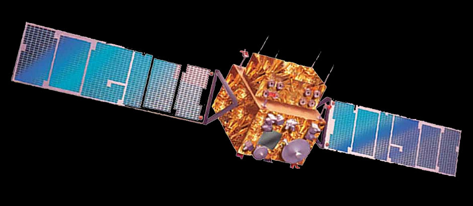
 The Indian Remote Sensing Satellite IRS- 1 C was successfully launched into polar orbit on 28 December 1995. Its sensors were activated in the first week of January 1996.
This satellite was followed by IRS- 1D that was successfully launched into polar orbit on 29 September 1997. Its payload was activated in mid-October 1997.
The Indian Remote Sensing Satellite IRS-P5 Cartosat-1 has been successfully launched into polar orbit on 5 May 2005. The payload was lifted by the PSLV-C6 and for the first time the new Second Launch Pad at Satish Dhawan Space Centre was used. The satellite has two panchromatic cameras that were especially designed for in flight stereo viewing.
IRS Cartosat-2 was successfully launched into polar orbit on 10 January 2007.
IRS Resourcesat-2 was successfully launched into its intended polar sun-synchronous orbit on 20 April 2011 from Satish Dhawan Space Centre by the Indian PSLV-C16. This was the 17th consecutive successful flight of India's Polar Satellite Launch Vehicle.
- Cartosat-2 Pan products, with 0.8 to 1.0 metre resolution, depending on the across-track tilt employed, the width of a single spot image varies between 9.6 km and 12 km. Data products allow the fulfillment of mapping tasks up to 1:5000 scale.
- IRS-P5 Cartosat-1 PAN-A and PAN-F products, with 2.5 m resolution and size of 27 km x 27 km, PAN-Fore and PAN-Aft data products allow the generation of DEMs and the fulfillment of mapping tasks up to 1:12,500 scale.
The standard delivery time for small and medium-sized orders varies from 3-10 working days.
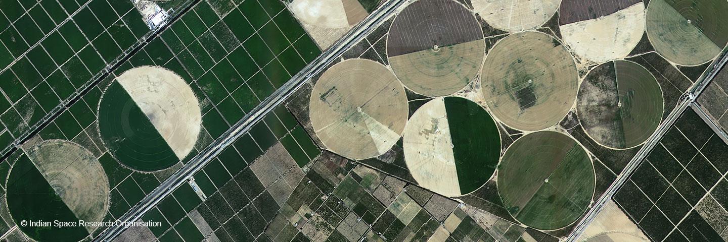
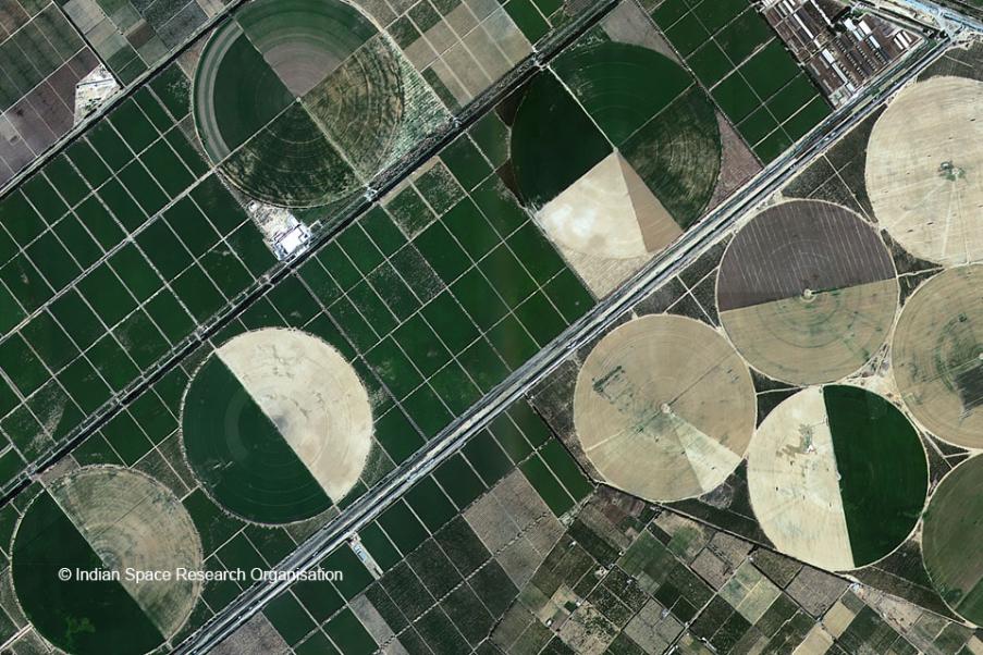
In January 2005, Euromap started the systematic acquisition of IRS-P6 data from the European footprint of the Neustrelitz ground station. Simultaneously acquired LISS-IV Mono, LISS-III and AWiFS data are recorded whenever possible.
The standard delivery time for small and medium-sized orders varies from 3-10 working days.
IRS-1C/1D Data Products
Since 1996 Euromap has systematically acquired IRS data from the European footprint of the Neustrelitz ground station. Simultaneously acquired PAN, LISS-III and WiFS data are recorded whenever possible. Our archive of an almost cloud free coverage can be processed into 5 m natural colour products.
The following introduces the data types with their basic properties.
The standard delivery time for small and medium-sized orders varies from 3-10 working days.