


London Motion Map Program (MaP) is designed by Telespazio UK to provide monitoring of ground motion in London and beyond.
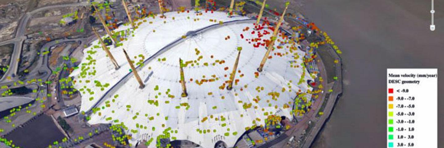
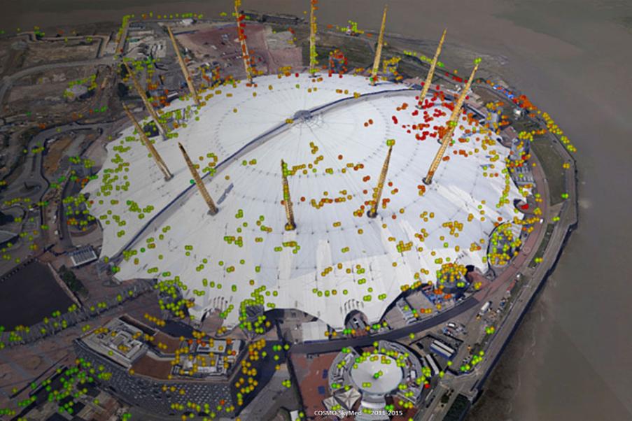
We use Persistent Scatterer InSAR (PSI) with high resolution satellite imagery to identify surface movement with millimetric precision.
Through the technology, we are also able to understand how much each major underground infrastructure is affecting London’s ground surface, including movement interaction between different major underground infrastructures to clarify liabilities. As part of this work, Telespazio UK has developed a baseline survey to keep monitoring in the future quickly and effectively.
Addressing the Infrastructure Lifecyle
Planning & Design Phase
Risk planning management:
- Full survey for identification of sensitive areas to movement
- Prior movement detection to clarify liabilities in case of construction-induced movement
Construction Phase
- Measuring beyond the reach of in-situ instrumentation along track
- Cost-effective survey just after construction in settling areas
- Complementary and independent measurements
Operations & Maintenance
- Long-term monitoring after in-situ instrumentation has been removed
- Planning of surveying campaigns for maintenance
- The baseline dataset analysis is already available as an off-the-shelf product with quick delivery providing high resolution surface motion for the London area from 2011-2015 from the COSMO-SkyMed satellite.
- Areas of Interest can be purchased from Telespazio UK at very competitive prices.
Contact us for further information on pricing, terms and conditions.